STATUS UNAVAILABLE
The live state feed for this segment is not connected yet, so no current status can be shown. Check DriveNC or TDOT SmartWay before you drive.
Last updated at: NOV 20, 2026, 4:26 AM EST · DriveNC and TDOT SmartWay
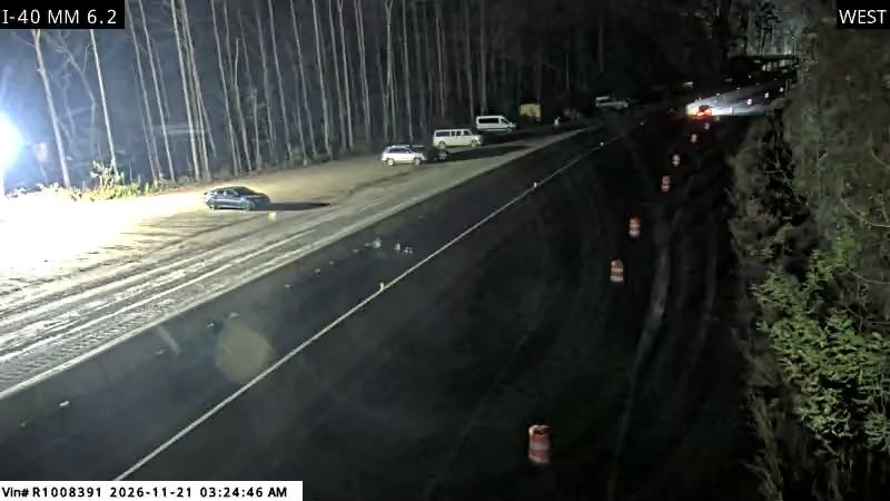
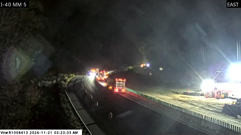
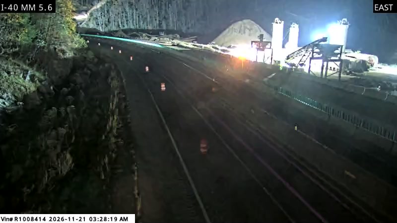
State DOT cameras inside the gorge, in driving order. Still images from DriveNC and TDOT SmartWay, credited to NCDOT and TDOT.
Right now, the live status for Interstate 40 from the Tennessee state line to Newport cannot be shown, because the state feeds are not connected yet (page rendered NOV 20, 2026, 4:26 AM EST). Check DriveNC or TDOT SmartWay before you drive.
No gorge events can be shown yet, because the live state feeds are not connected. This section fills in from the agency feeds the moment the developer key is set.
How restrictions work here, in the states' own terms, is on the restrictions and advisories page.
Forecasts and current conditions: National Weather Service.
I-40 gorge closures, rockslide and flood alerts, and Smoky Mountain weather between Asheville and Knoxville, straight to your inbox. Unsubscribe at any time.
Interstate 40 through the Pigeon River Gorge is not a straight highway that happens to pass a river. It is a road built inside the gorge, following the Pigeon River as the river cuts between North Carolina and Tennessee through the mountains on the edge of Great Smoky Mountains National Park.
The river sits close beside the road. The rock walls rise close on the other side. In long stretches there is very little room beyond the travel lanes, and in many places there is almost no shoulder to pull onto. The road curves with the river, passes through a tunnel on the North Carolina side, and runs through ground that leaves engineers few choices about where to put pavement, barriers, or work zones.
That tight fit explains almost everything drivers feel here. When traffic is light, it is a beautiful drive, with the river in view and forested slopes above. When traffic is heavy, when a truck slows on a curve, when fog settles on the water, or when anything goes wrong in a lane, there is nowhere for the problem to go. The gorge does not absorb delays the way a wide road with broad shoulders and frequent exits can.
This is also a working freight road, not only a scenic one. I-40 here is a primary east coast to midwest truck route, with a truck share of 23 percent, which at 26,500 vehicles a day means about 6,100 trucks a day. Cars headed to the Smokies, families headed to Asheville or Knoxville, and long haul trucks all share the same narrow ribbon, with no practical alternate route through the mountains for most of them.
In September 2024, Hurricane Helene washed the eastbound lanes of I-40 into the Pigeon River in multiple places. The gorge closed completely, and it stayed closed for five months. For a road with no close parallel route, that closure cut the direct link between Asheville and Knoxville and forced through traffic onto the long detour.
The road reopened on March 1, 2025, but not as the road drivers remembered. Since that reopening, I-40 through the gorge has run one lane each way at 35 mph over about 12 miles, from Exit 7 in North Carolina to Exit 447 in Tennessee. Temporary barriers separate the directions, and work to build the permanent road continues beside the lanes carrying traffic.
Day to day, three things follow. First, the 35 mph limit covers the heart of the gorge, so the trip takes longer even on a good day, with no passing opportunity to recover time. Second, the road has no spare capacity. One slow vehicle sets the pace for everyone behind it, and one crash, stalled truck, or piece of rockfall work can back traffic up in both directions. Third, delays are worst when demand is highest. NCDOT has warned that delays grow on Friday through Sunday afternoons and on holiday weekends, when tourism, intercity travel, and freight peak at once.
The timeline matters. Tennessee side work is scheduled to finish in fall 2027. Three lanes are expected by late 2028, and all four lanes by late 2029, as part of a permanent rebuild NCDOT puts at about $2.8 billion. In plain terms, the one lane pattern is the normal condition through late 2028, not a short interruption. Checking conditions before a gorge trip is not being cautious. Until the rebuild is done, it is simply how this drive works.
The Helene washout was the largest recent failure in the gorge, but it was not a surprise to anyone who knows the road's history. The gorge has been closing for rockslides since almost the day it opened.
The first rockslide closure came in February 1969, four months after the road opened. In 1985, a rockslide closed the road for nearly nine months. In July 1997, a rockslide closed the road for more than two months and injured five people. In October 2009, a massive rockslide closed all lanes, and the road did not reopen until April 2010, about six months later. In January 2012, another rockslide closed the westbound lanes for months.
Water is the other recurring cause. On June 18, 2025, three inches of rain fell in about three hours. The road flooded, another rockslide came down at mile marker 450 in Tennessee, vehicles were trapped in the water, and the gorge closed completely again for nine days. That flood happened on the temporary road, less than four months after the March reopening, and it showed how fragile the current pattern is in heavy rain.
Two lessons follow. Closures here are not rare freak events. They are a recurring feature of a road cut into steep, wet rock above a river. And rain deserves as much respect here as snow does on other mountain roads. A forecast for heavy rain in the gorge is a reason to check conditions, consider timing, and know the detour before you leave, especially while the road is in its temporary form.
Fog is the weather drivers talk about most on this road. The river, the elevation change between the approaches and the gorge floor, and the swings between night and morning temperatures create thick fog in the gorge on a year round basis. It can arrive in patches, so a driver can move from clear road to very low visibility in a short distance, on a curve, with a truck ahead and no shoulder beside them. Local news in Asheville and Knoxville covers fog and crash days in the gorge as routine news, because for this corridor they are routine.
The response is simple. Slow down before visibility drops, not after. Leave more following distance than feels necessary, use low beam headlights, and do not stop in a travel lane if you can avoid it. Expect any slowdown to bunch up inside the one lane section, where there is no room to spread out.
Rain is the second factor. Heavy rain raises the river, softens slopes, and has repeatedly triggered flooding and slides. Winter weather is real but secondary: snow and ice affect the Haywood County mountains on a handful to a dozen days a year, and both states handle it by posting advisories, restrictions, and closures. There is no chain control system on this corridor, and no chain tiers or traction checkpoints of the kind used on western passes. Summer thunderstorms can soak the gorge while the approaches stay dry, and fall foliage season in October is one of the biggest travel months. Weather checking belongs in trip planning in every month here.
Ask drivers who use the gorge regularly what worries them, and the answer is usually the same combination: trucks, curves, speed, and nowhere to go.
The gorge is curvy by interstate standards, because it follows the river. Trucks that enter curves too fast, cars that follow too closely, and drivers distracted by the scenery all create risk on a road with almost no shoulders. When a vehicle breaks down or a minor crash happens, there is often no shoulder to move it to. The vehicle stays in or partly in the travel lane, and in the current pattern that lane is the only lane. Traffic does not slow around the problem. It stops behind it.
That is why even a minor crash ties up this road so completely, and why NCDOT keeps a quick tow contract on the corridor. Getting a disabled vehicle out of the lane fast is the difference between a short delay and a backup that stretches out of the gorge in both directions. It is also why crash delays can appear with no warning on an otherwise normal day, and why a conditions check made an hour ago may no longer describe the road.
For car drivers, the guidance is patience and space. Do not tailgate trucks on the curves, and do not try to force a pass where the road narrows to the work zone. For truck drivers, the gorge demands the posted speed, especially at 35 mph through the one lane section, and extra caution in rain and fog, when the margin for error shrinks to the width of a barrier. Speeding, including by trucks, has been a documented problem here. Drive at the limit posted for the gorge, not at the speed the rest of I-40 allows.
Good gorge trips start before the on ramp. Check the verdict on this site on the day you travel, and check it again close to departure on a long trip, because crashes and weather can change the picture quickly. Look at the cameras to see the one lane section and the approaches with your own eyes. Look at restrictions for any posted truck, oversize, or temporary rules that affect your vehicle. Then decide on timing.
Timing is the one lever drivers control. If you can avoid Friday through Sunday afternoons and the middle of holiday weekends, do so. Early departures generally meet lighter traffic than midday or afternoon departures in peak season. Build extra time into any trip that includes a flight, a check in, a reservation, or a park plan on the other side. A trip from the Asheville metro of about 490,000 people to the Knoxville metro of about 920,000 people, past a park that draws about 12 million visitors a year, through a one lane work zone, should never be planned to the minute.
Know the detour before you need it. When the gorge closes, the detour is via I-26 to I-81, which adds about an hour. Do not invent a shortcut on unfamiliar two lane mountain roads in bad weather. You would trade a known delay for an unknown and riskier one. If the verdict is closed, take the posted detour and let the people waiting for you know early.
Finally, fuel up and take breaks on the approaches, in Waynesville or Canton on the North Carolina side, or Newport on the Tennessee side, rather than assuming you can stop easily in the gorge. Most gorge trips, even now, are simply slower than they used to be and then uneventful. Planning is how you keep a slow day from becoming a ruined one.
Right now, the live status for Interstate 40 from the Tennessee state line to Newport cannot be shown, because the state feeds are not connected yet (page rendered NOV 20, 2026, 4:26 AM EST). Check DriveNC or TDOT SmartWay before you drive. As background, the gorge has been open since March 1, 2025 in a reduced pattern of one lane each way at 35 mph over about 12 miles, from Exit 7 in North Carolina to Exit 447 in Tennessee, with temporary closures since then for flooding, rockslides, and major crashes. Open does not mean normal on this road until the rebuild is finished.
The one lane, 35 mph pattern is expected to remain the normal condition through late 2028. Tennessee side work finishes in fall 2027, three lanes are expected by late 2028, and all four lanes are expected by late 2029. Until then, plan every gorge trip around the reduced pattern.
The detour is via I-26 to I-81, which adds about an hour to the Asheville to Knoxville trip. Follow the posted detour rather than local mountain roads, especially in rain, fog, or winter weather, when unfamiliar two lane roads can be slower and less safe than the interstate detour.
No. There is no chain control system on this corridor. North Carolina and Tennessee post restrictions, advisories, and closures instead. In snow or ice, follow the posted advisories and closures for this stretch, slow down, and check conditions before you leave. Do not look for chain tiers here, because none exist for this road.
Because there is almost no shoulder and, in the current pattern, only one lane each way. A disabled vehicle or a crash often cannot be moved out of the travel lane, so traffic stops behind it until it is cleared. NCDOT keeps a quick tow contract on the corridor for exactly this reason. That is also why delays can build quickly and why checking conditions close to departure matters.
Road conditions, events, and camera data: the North Carolina Department of Transportation (NCDOT) via DriveNC and the Tennessee Department of Transportation (TDOT) via TDOT SmartWay. Weather forecasts: the National Weather Service.